 Live Music Archive
 Librivox Free Audio
 Metropolitan Museum
 Cleveland Museum of Art
 Internet Arcade
 Console Living Room
 Books to Borrow
 Open Library
 TV News
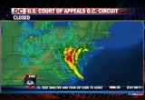
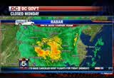
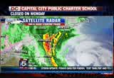
 Understanding 9/11
tv Fox Morning News FOX October 29, 2012 7:00am-9:00am EDT
7:00 am

we will probably not forget this date. looks like everyone is taking the warnings about sandy quite seriously. metro as we said is closed today. that includes all rail, bus, and metro access service. the federal government is closed. d.c. government offices also closed and so are most schools. for a full list, please go to our website, myfoxdc.com. it looks we're running close sures at the bottom of your screen there. fox 5 is all over this morning. >> fox 5 all over this storm as you said. we have crews tracking the storm in ocean city, annapolis, and fairfax county. but we begin with tucker barnes. he has the latest on sandy's changing path. >> since you went bed, san i cannen i did continues to intensify.
7:01 am
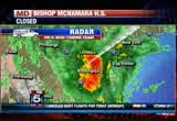
that pressure's been falling overnight. when the pressure falls, that tells us the storm's getting stronger. a lot of reasons to be concerned about later this afternoon, tonight, as the storm makes its way inland. this is the real deal now, outer bands, yellow and red working across maryland and virginia, now really making their presence felt. the rain has been picking up pace, and will likely be moderate to heavy at times here during the course of your morning hours. that's stage one, first the heavy rains move in, then the winds. let's take a closer look at your storm system. there you go, you can see the heavy rain throughout the beltway, south and east of the city, southern maryland getting some very heavy rain, parts of prince georges county. let's see out towards annapolis is getting good rain at the moment as well. you're out towards the west, you too will get in on the heavy rain. all of this is pushing out to the west. here's a look at your storm and
7:02 am
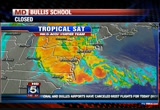
as i mentioned, actually growing in intensity, if you look at the right side, you'll see for just a moment, it developed an eye wall and eye structure last night. then it disappeared again. it's now being covered by overcast, that's the big blob you see, but as i mentioned, maximum winds, 85 miles per hour. big change from last night, it's now tracking to the north and we're expecting that north we recall and eventually north western. this will indeed make land fall somewhere across northern delaware, southern new jersey here later this evening. maybe 8:00, 9:00, 10:00 tonight. you can see it starting to make that turn. we're going to be in for a day long adventure. i think by late this afternoon, particularly tonight, the winds could gust hurricane force around here. please take it seriesly. this is going to be a very serious event. tropical models, i want to show you a feature here, you can see
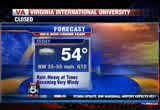
7:03 am
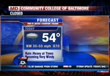
that they stay tightly bounded here as they get on shore then notice what happens, the latest track taking it across northern maryland and some of the models have it doing a loop across central maryland, maybe dipping down to dc. either way this is going to be serious. this is not a scenar that will be favorable to washington if this tracks closer, we would be dealing with the strong winds. again, it's more and more likely we will see winds approaching hurricane force here late this afternoon particularly tonight. 54 your daytime highs. becoming windy later on this afternoon. they'll be very heavy this afternoon and tonight. more details on the weather in just a minute, back to you. >> thank you. well it is unfortunately a sure bet that many will lose power in this storm. >> you can still stay in touch with the rest of the fox 5 weather team on your smart phone. if you haven't done so, take a moment to download the fox 5
7:04 am

weather app. you're seeing it on your screen right now, it's free for iphones androids. you'll get the latest storm strategy, and tweet with our weather team. >> i must say i did it several times within every hour over the weekend. julie, what's going on? >> not a lot right now, that's a good thing for folks out on the roads because i think a lot of people have that day off there, often stay at home, stay honkered down which is a good thing. we have dealing with a wet pavement, some of our roadways just literally leave covered. a lot of leafs on the road making for a slippery drive. keep that in mind. slow it down out here on the highway. there is one accident southbound 95 at quantico, that's in the process of being cleared over to the shoulder. now we do have issues with metro rail service, allison talked about that, also services suspended on amtrak's northeast quarter. you'll also find metro bus, metro access, and of course
7:05 am

montgomery county right on bus service suspended because of sandy. we do have road shut downs such beach drive. little falls parkway between massachusetts avenue and river vehicle code blocked off. again, these are typicay areas where when we do have heavy rain, we have flooding, of course with the winds that we are expecting that tucker's talking about, there could be a lot of tree debris that needs to be cleaned up. these have been shut down in preparation for sandy. of course we have wind restrictions not only at baltimore ski bridge, but headed towards ocean city, it remains closed off until further notice. philadelphia road, route 90 still open at this time. that's a check of your fox 5 on time traffic. thank you very much. conditions up and down the coast continue to worsen this morning as hurricane sandy inches closer and closer. >> heavy rain and high winds
7:06 am

creating dangerous conditions. many roads now flooded. lauren is live in ocean city this morning with the latest, lauren. >> reporter: good morning, tony, the rain kind of coming through in bands as tucker has been saying. right now a little bit lighter even though you can definitely see it, definitely feel it. it's a little later than we have been experiencing. pretty cool, starting to get a little bit chilly out here. the wind, sustained winds, 20 miles an hour up to 37-mile per hour, gusts, and of course the big story is the waves. we've got some video of earlier waves crashing over the sea wall, actually felt across the board walk and into the pool, outdoor pool at our hotel. on the board walk itself, currently covered in that sea foam. we also at times when the waves crash over several inches of water will be running down the board walk. as far as rain fall, more than an inch and a half of rainfall
7:07 am

in ocean city, maryland, at this point. a lot of the roads certainly flooded. we saw that earlier about 3:00 a.m. so definitely the case now. everything below 17th street is closed off, there were mandatory evacuations in place. about 200 people we're told did stay. so hopefully they are honkering down, it's expect to get worse. the mayor has said that the surge that we're seeing here on the atlantic coast not the only concern. >> our biggest concern again, i think is the, excuse me is the surge, the water surge from the bay side and the intensity of the storm and the duration of the storm. as the storm turns into a nor'easter type of event, during numerous high tide cycles, that's going to cause some problems.
7:08 am
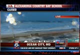
>> reporter: so the ready for folks on that side of town. everything south of 17th 17th street shut down, also concerned about flooding in low lying areas and route 50 closed off, the entrance to ocean city, 90 does remain open at this time. we're seeing some of the waves character over the sea wall. it has not seen a major breach since it was constructed after hurricane gloria in 1985. so everyone here kind of watching and waiting to see what happens. we did have these streetlights on the board walk go out for some time. we were thinking possibly they shorted out because our hotel has not lost power, but that's something we will be watching out for. and high tide set for just about an hour and a half, about 8:20 this morning. so particularly high because of the full moon, about 5% higher than normal. again, we'll be watching, and we'll keep you updated live in ocean city, maryland, fox 5 morning news. >> thank you. >> hopefully we'll be watching
7:09 am

too. it'll be 8:20, so we'll try and see that. thank you. now to virginia where flooding is already a problem in some spots, heavy rain has the elizabeth river surging. several roads are closed and several morcould follow suit. hundreds of people have already lost power, governor bob mcdonald authorized members of the virginia national guard to help. and fema activated the fairfax county search and rescue team. >> crews will be heading out later this afternoon. melanie, good morning. >> reporter: good morning allison and tony, that is just one of the ways that fairfax can be the isgetting ready. the urban search and rescue team mobilized yesterday. they spent a good part yesterday packing up their gear and they will be mobilizing this morning until they get the call from fema in terms of where their skill set is most need aid long eastern sea board. we are here in fair lakes we've
7:10 am

been out in front of the 24 hour wal-mart here. probably since before 4:00 this morning, i think we're getting a blast of things to come, ere none a while, we get a cold icy wind blast. and we can see that things are going to get much worse. i want to bring in this person who was kind enough to brave the roads this morning to talk to us a little bit about how things are going in the didn't. you said nothing closed so far, but everybody is on the ready. >> no roads are closed, but the government and schools are both closed. however our emergency activation center is there. there are many people there trying to keep everybody safe. we want everybody to get where we need to be before the weather gets bad. when it does start flooding or when there's really high winds. everybody should turn around and don't drown. we're worried about people trying to drive through flooded streets. when the road is full of water, turn
7:11 am

around, don't drown, and take safety precautions, hopefully everybody is prepared. we did have warning that this storm was coming, i think by the end of the day, it's going to be quite dangerous for peopling to out and about. >> reporter: we are seeing people here trying to get perhaps lastmen supplies. if you had to go out, you could do it even though it's not recommended. >> at this point, it's not as bad as it will be, this afternoon we're going to start having the very, very high winds and the rain will get much, much worse than it is now. so if people still need to pickup a few things, you have a little bit of a window of opportunity, people then should get ready to settle down and be inside for a long while. >> reporter: thank you so much. and i've got to tell you, i did take a quick little tour around wal-mart, no d batteries left inside, and no flashlights or lanterns as well. but there are plenty of gigantic bins of cheese curls if perhaps that was on your
7:12 am

supply list, tony and allison. >> well, it wasn't, but it sounds like a good idea at about midnight, thank you so much. ay the new york area is expected to get the worst of this superstorm. some 375,000 people in lower manhattan and other parts of the city have been ordered to evacuate. the subway system is closed and the new york city stock exchange will also be shut down today. and on broadway, all performances for tonight have been canceled. it's always a sad day when broadway goes dark. hurricane sandy coverage continues after the break. we're going to take a closer look at what power companies along the east coast are doing to prepare for the possibility of millions of outages. and as we take you to the break, you will to want have these numbers handy in case your power goes out. these are the numbers to report outages and check restoration times. we've also got all this information on our website, my fox dc.com. your closures are at the top of
7:13 am

your screen. we'll be right back, 7:112. anncr: which do you believe? what mitt romney's tv ads say about women? or what mitt romney himself says? mitt romney: do i believe the supreme court... should overturn roe v. wade? yes. and it would be my preference that they, that they... reverse roe v. wade. hopefully reverse roe v. wade. overturn roe v. wade. planned parenthood, we're going to get rid of that. i'll cut off funding to planned parenthood. anncr: no matter what mitt romney's ads say. we know what he'll do. i'm barac amanda knox


7:16 am

it is 7:16 now, the hurricane is effecting the presidential race. president barack obama is scrapping plans now to campaign in three states and he just canceled a rally this morning in florida. he is now returning from florida to monitor hurricane sandy. mitt romney is still campaigning in ohio, iowa, and wisconsin today. he canceled three stops in virginia yesterday, and an event scheduled in new hampshire for tomorrow. hurricane sandy is also causing trouble with early voting. after long lines in saturday, today, early voting is canceled in maryland, the governor declared a state of emergency. the dc board of elections will decide later today if early voting will be canceled tomorrow. all right chuck sharon with
7:17 am
us once again to bring us the latest on this storm which intensified overnight. >> in fact, pressure down about an hour ago, i know to most people that doesn't mean a lot, to the weather people, that tells us it's only getting stronger. i want to emphasize again, i know the weather people are prone to hyping thins. this is the real deal. we're not hyping it. this is a serious weather event. in fact, i've lived here honestly most of my life, and i can't remember a storm no this strong, even isabell was passing further to the south and west. we know how much damage that did. we can look forward to the same thing i'm afraid. there you go, that's an outer band associated with sandy, now moving in, and starting to get pretty good rain rates here along the 95 corridor, earlier they got rain overnight. we'll continue to see anesthesia banding effects during the course of the day. you'll see heavy rain, get a bit of a break, and it'll pickup again as the storm approaches from our south and
7:18 am

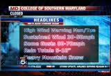
east. the storm's still south of washington. we still have several hours before it makes land fall. i want to show you again the rain showers moving in. districts here south and east getting the heaviest rain. that's your highest rain rates. we're expecting rain totals unfortunately in the range of five to ten inches by this time tomorrow. really by tomorrow afternoon, rain is going to be one of the big issues here over the course of the storm. let's do headlines and we have a high wind warning when which goes into effect at 8:00 through tuesday night at 8:00 p.m. looks like we'll have winds at 30 to 50 miles per hour. and gusts approaching 70 miles per hour and some of the latest guidance, some of the model guidance suggesting we will see hurricane-forced winds very close to the washington area later tonight. the winds are going to pickup during the course of the day, if you go out now, it's just breezy. the heaviest winds will move in later tonight. it will be dangerous, dangerous winds around here for a time
7:19 am
later this evening overnight tonight. gusts 70 plus in some spots. we have a hurricane wind warning along the chesapeake. we have a flood watch as well, and have barely touchedden to all morning, but to our friends to the west, west virginia, western maryland, blizzard warning up to two feet of snow. if you're travel together west, be mindful that the snow, once it starts to fall out there will be very heavy and quickly accumulate. that's going to be another big issue as we get into the overnight hours. check out your tropical wind field, i mentioned the winds. we're just winds to about 30 miles per hour now. here we are at 3:00, down along the shore, they're starting to see the winds pickup by 3:00, and then across the bay here by 6:00, 7:00 tonight we'll see winds in excess 55 to 60 miles per hour. i want you to notice what happens here by midnight. this is the big change. i'll push it up to 1:00 a.m. see the red there?
7:20 am

that's indicating hurricane- force winds. this is just the computer model, can't guarantee this is going to happen, you know, got to be concerned about the possibility of it as this is the first i've seen of the possibility of hurricane-force winds right here in washington later tonight. tomorrow, things will still be blustery if we get into the overnight hours during the day tomorrow, things will gradually get better. 20 in leonard town, there's the forecast, 54, winds north and west, 35 gusting to 7037 worst is yet to come later tonight. >> i want to thank you, but i want to thank you. i appreciate the information. we'll see you in a couple of minutes, tucker. >> all right thank you. okay, well with the likelihood of massive power outages, most us want to know whether the power company will be able to handle the aftermath of this this storm. >> utility companies have been bring imworkers from other states not impacted by the
7:21 am
storm. clay is here. >> i am here, good morning, good morning. >> good morning. >> let's talk first of all about these preparations and the calling in of crews, what strikes me is that so much of the region, the mid-atlantic, clear into the northeast is going to be impacted. how hard is it to get extra crews to come here for they haven't? >> tony, that is a great question and it has been difficult. my understanding is that for us, we brought in several hundred folks that came in yesterday from alabama and louisiana. but there are thousands of crew, i should say over 10,000 crew requests across the country that still has have not been covered. so that's a very good question. everybody has asked from maine down to virginia, hampton road, and you know, millions of people are effected. we were just one of dozens of utilities that are asking for mutual assistance. they're waiting for the storm, thousand tracks, how it lands,
7:22 am

but fortunately for us, we have several hundred in addition to the crews that we have and we're going to try to bring in a few more today before those winds make it difficult and unsafe to travel. >> and clay, just to make sure i'm clearen to, when you request, that means that we will get those hundreds of extra crew, is that how that works? >> no, no, no, when we, we requested for example 2500. >> okay. >> when you have them committed that means that they are committed to you and your utility whether it's pepto, what have you. so we have about 400 additional men and women that were committed, came into the property, they are on the property at the fairgrounds as we speak. so we do have out of town crews that are here. >> okay. >> we've asked for hundreds more that are not here, but that's going to depend again on the storm. it's effects and where they're needed most. >> clay, obviously with winds, you know, up to 70 miles an
7:23 am

hour possibly, and sustained winds of 50 miles an hour, 50 were 60 later on. obviously you all are anticipating would it be fair to say massive outages? >> substantial. massive sounds tony so massive. substantial. but yes, yes, yes, this is not the time to quibble over adjectives. with our bucket trucks, threshold is 30 to 45 miles an hour. we're talking 18, 24 of winds greater than 40 miles an hour sustained, so the bucket trucks to crews, due to safety regulations can not perform taking trees off of wires, removing trees and the position in the bucket truck. that adds to why we say this will be a long term, or should say a protracted prolonged outage because we can't do the work. now, from internally, from our transmission station substations, we'll be able to
7:24 am
move some switches and move some power around, but when your neighborhood's impacted, someone says there's a tree on my front lawn, there's a tree that knocked down wires, winds are gusting 60, 70 miles an hour, unfortunately, we're going to have to wait. it's going to take a few days. >> we want you all to be safe as well. thank you, thanks for joining us by phone. clay of course from popco. >> i like substantial better than massive as well. thank you clay anderson. >> we'll be right back. t back. [ minto ] you know, those ads saying mitt romney would ban all abortions and contraception seemed a bit extreme. so i looked into it. turns out, romney doesn't oppose contraception at all. in fact, he thinks abortion should be an option in cases of rape, incest, or to save a mother's life. this issue's important to me, but i'm more concerned about the debt our children will be left with. i voted for president obama last time,
7:25 am

but we just can't afford four more years. [ romney ] i'm mitt romney and i approve this message.

7:27 am

well as we brace for hurricane sandy, the caribbean is still suffering. the storm-related death toll is risen to 65. 51 of those reported in haiti and making the situation even worse, continued rain. >> the coast guard is monitoring a tall ship that's in disstress off the coast of north carolina. the hms bounty is a replica of the ship made famous in the movie mutiny. this morning it has 17 people on board, just off the outer banks as hurricane sandy swirls northward. it is taking on water and has no engine, but the coast guard
7:28 am

can't launch a rescue because of the weather. coming up, conditions are worsening by the hour. a in delaware, sandy continues to move up the northeast. live report from the beach after the break. president obama: there's just no quit in america... and you're seeing that right now. over five million new jobs. exports up forty one percent. home values... rising. our auto industry... back. and our heroes are coming home. we're not there yet, but we've made real progress and the... last thing we should do is turn back now. here's my plan for the next four years: making education and training a national priority; building on our manufacturing boom; boosting american-made energy; reducing the deficits responsibly by cutting where... we can, and asking the wealthy to pay a little more. and ending the war in afghanistan, so we can... do some nation-building here at home. that's the right path.
7:29 am

so read my plan, compare it to governor romney's... and decide which is better for you. it's an honor to be your president... and i'm asking for your vote... so together, we can keep moving america forward. i'm barack obama and i approve it's my coffee when i want it. you press a button, you have great dunkin' coffee. i got my coffee for the morning, i got my dunkin' k-cup packs for the rest of the day. only available at dunkin' donuts restaurants. america runs on dunkin' coffee. we had a good group of people. good group of employees out there. this was a booming place. and mitt romney and bain capital turned it in to a junk yard. i was suddenly, 60 years old. i had no health care. mainly i was thinking about my family. how am i going to take care of my family. he promised us the same things he's promising the united states. and he'll give you the same thing he gave us. nothing. anncr: priorities usa action is responsible for the content of this advertising.
7:30 am

and this is maryland. teacher: this is west virginia, pennsylvania, delaware. every year marylanders spend five hundred and fifty million gaming at casinos in these other states. question seven will build a new casino and bring table games to baltimore... generating hundreds of millions for schools. and that money has to go to education. it's the law. so vote for question seven. so we can stop spending all that money here, and keep maryland money in classrooms like mine. welcome back it's 7:30, we are back with a live look at
7:31 am

hurricane sandy's path as you can see, massive storm is slowly swallowing up a good portion of the east coast. not sure if i like putting it that way. >> swallowing up? no thank you. >> moving on shore. >> the center is expected to make land fall north of delaware. that's where we are live this morning. doug, what are the conditions right now? >> reporter: good morning, well you have the whole board walk here to yourself, that's just about the case here, it seems bad, especially when you look at the beach here. this huge wave coming in, check the buoy data offshore, wave heights of about 23 feet or so. wind speeds 40 to 50 miles an hour. those kinds of winds, they are certainly on their way. this is one of those storms where it may not matter where the eye comes across because it's so massive people are going to be feeling the effects hundreds of miles in every
7:32 am
direction. the waves just keep growing, still along the peninsula, we found these two guys taking advantage of unusually big sur. >> god blessed up with this storm, let's have fun it with it. >> reporter: not everyone sees it that way. it's called a megastorm, spinning where it can no longer be seen from space. slamming into the most densely populated part of the country. >> we could see hurricane-force winds, in fact we expect hurricane-force winds anywhere from the dell march through new york. >> reporter: in new york city, subwaist and mass transit are already closed. hundreds of thousands are under mandatory evacuation orders and other cities are following suit. >> you can see all this foam that's gathering on the beach here, and take a look at the waves offshore, continuing to build. the wind speeds are building too, but the fear from sandy isn't just the wind, it's this water that's just going to
7:33 am

inundate these low lying areas causing extreme flooding. >> we have to take this seriously. >> reporter: president obama toured fema headquarters yesterday. both he and governor mitt romney have had to either cancel or postpone campaign events because of the storm. moms are now bracing for sandy's full impact, even if some are finding a silver lining in those gathering clouds. >> a lot of people would say you're crazy. >> i'd agree. >> reporter: i can tell you not too many surfers are out there right now. we've been watching as the beach is inundated with these waves, of course the morning high tide here about 20 minutes away. tony and allison. >> all right, we'll checking in, thank you doug. >> thanks, doug. you guys are so busy, we appreciate it. >> so busy. even when i worked on sunday morning at ocean city, the water levels were already a foot and a half above normal at that point, but you can just
7:34 am

imagine now what's going on out there. >> right. >> this storm is huge, and really a monster storm. and as tucker mentioned earlier, we cannot stress enough for people really to take it seriously. let's get a look now at our maps and show you what is going on. let's look at sental radar. here we already have some of those rain pushing through our viewing area here. some a little bit heavier than in other areas right here just along the i-83 corridor. we've got heavier baches here. this is going to intensify and continue through the course of the day. look out here to the west, we been talking about the colder air surging its way in due to a frontal system and seeing some snow, and already some of this is starting to develop. we expect to see that continuing over areas of the mountains as well into the course of the day. let's look at the rainfall that's anticipated, anywhere from eight to ten inches for the dc metro area, could see isolated amounts up to 12- inches. we can't rule that out to the north. six to eight inches is possible.
7:35 am
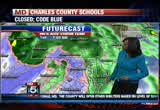
do not go out there driving and think that you can master this through any low lying areas, it's really not worth that chance. as we look at 11:00 this morning, rain continues to be steady and heavier. right into the 5:00 hour, you can still see label the of wintery mix here, the snow continuing to areas to the west. 11:00 tonight, still no break. this continues to tuesday. future cast trying to bring a little of this cooler air in across our area on tuesday. so we're going to watch this very closely as well because it's showing a little bit of the mix here, but mainly we are talking the heavy, steady rainfall is what's going to be causing a lot of the flooding conditions as well as the wind throughout the area. sandy, snowy side has prompted blizzard warning for the mountains as well as the islandlands and into parts of the panhandle of west virginia. this is where we have six to 12- inches of snow possible in the higher elevations and really there are chances as well into the higher mountains and we
7:36 am

could see even, maybe even 18 to 20-inches through here. this is where we have the warning in effect today through 4:00 this afternoon until 8:00 on wednesday. and with the winds kicking in, it's only going to make it worse. the snow and gusty winds are really going to be an issue for them. the blizzard warning in effect, we're talking hey, wet snow, six to 12-inches plus possible. winds there will be gusting up to 60 miles an hour. with those blizzard conditions, you definitely can expect that you're not going to be able to see anything out there. visibility will be pretty much down to nothing and if you are living in those areas, do not venture out. here's a look at the wind field, the one thing is that the wind field is so massive, right now hurricane-force winds are extending some 175 mimes from the center of this storm, and even more for tropical storm force winds, 485-miles from the center. we're already starting to feel that along the coast, it's only going to get worse as the storm system moves closer. we're going to see these storms continuing. storm surge is a big issue
7:37 am
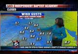
because once it makes land fall, we're going to get a little bit of a southerly wind flow. it's going to push water up from the bay as well as from the title pa toe mic, we're going to see prolonged and extended times and periods of coastal flooding continuing. it's also going to effect small streams and bay areas as well. winds now gusting anywhere from about 18 to 29 miles per hour. look at indianapolis as well as dc, that is going to continue to increase, and here's a look at what you can expect. by the time we get to noon tomorrow, 64-mile per hour wind gusts. these are dangerous winds. if you're in a high-rise, the higher up, the more you're going to feel that. you're going to notice it definitely. we get a little bit of a change as we move into the later part of tuesday. that storm surge is major, we're talking four to eight feet generally along the coast, as we move more to the north, six to 11 feet as you look along the jersey shore into new
7:38 am
york and right up through into parts of southern new england. so this is not just effecting us, it's going to be all the way up the board because this system is so strong and so massive. expect torrential rain and gusty winds. we have a high wind warning in effect. coastal flood warning in effect from tonight through until wednesday morning. and in the far west as we just showed you, we have that blizzard warning in effect as well. 50 million people will be effected by this storm. so it just goes to show how massive it is. here's a look at your seven day, we're going to get a break by thursday, wednesday we could still see some precipitation from it. then we get back to dry conditions as we move into the end of the week. we still have a long ways to go before that happens. and today is one of those days that as it wears on, things will start to deteriorate more into the overnight hours into tuesday 1 strike peak time for this storm system. once again, do not go out if you don't have to and please bring your pets inside as well. this is going to be dangerous weather for them.
7:39 am

let's check no in now with the roads and julie rice. you're right. the conditions right now not so bad. i don't to want give anybody the wrong idea just to hit the road and go. as you just mentioned, these conditions will deteriorate as the storm continues on for the rest of the today and into tonight and tomorrow morning. which means again you may not find flooding right now, but if you do, say for tonight on your travel back home, the theory is, turn around, do not drown. as these conditions continue to deteriorate, we're expected a number of power outages around the area. down trees and wires and conditions out on the road are just going to be dangerous. again if you don't have to be out there this morning, we strongly suggest you stay home and stay put. okay, southbound 29, i do have one accident to report here, that's tieing up the left side of the highway and in preparation for what we are expecting to be flood and storm damage, beach drive is shut down between 410. little falls parkway also blocked off. and parkway is closed off between wayne avenue and piney branch. again this is all in
7:40 am

preparation for sandy and the aftermath of what you will find. right now slippery road conditions and especially in areas where we have a lot of trees, i should say leaves that have come down over the weekend. makes for a slippery compute. metro rail service continued until further notice. also canceled today, and you'll find in montgomery county, bus service has been suspended. metro access, also suspended because of preparations of the storm. that's a check of your fox 5 on time traffic. >> thank you much. norfolk, virginia, is already seeing flooding. there are already a number of road closures, power outages. >> we are also tracking things further east, fox's jennifer davis is live in virginia beach with more on sandy's impact there. well, i can see it's raining, jennifer, tell us what's going on. >> reporter: good morning guys, yes, it is raining. we've been dealing with heavy rain since midday yesterday. our winds are in the 40-mile an hour range gusting to 50 or 60.
7:41 am

that's going to be a big deal. you can see the way it's turning, really ominously and ferociously out there. look at those waves, they are mammoth, they're bring up the foam we're tending to see. look at that splashing up on the board walk right there. really, they don't normally see it eat up the entire sea, they know how wide it can be down here. this is a big deal. they're used to riding storms out down here as a lot are, it's the duration of this one that is going to present a real challenge. >> and jenny, do you expect things to gradually improve there, you know, from the maps we're looking at, it seems the storm system is pulling away, is that the case? >> reporter: you know they told us to expect all of this at least through the day. but yes, it does look like it's speeding up a little bit as it heads north. it's not lessening really at this point, i think as the day goes on, there's a chance it will. still there's a big concern,
7:42 am

there's so many low lying areas that flood easily in a typical rainstorm. particularly over in norfolk, even yesterday as we were driving around, we hit a lot of intersections with standing water, we talked to one woman whose basement already. even when they've experienced is enough that it can make its narc this region. >> we know, home is here for you, let me ask you, and about pepco, we're used to the outages, can i ask you about power there in the tide water area? >> reporter: we still have it where we are right now. a few hundred people are without. at this point, they still have it, and many are hopeful gnat winds won't get too strong that they'll lose it, but the question is how long you have these sustained winds in the 40 to 60-mile an hour range. they don't have a lot of experience with that. you know, maybe they've seen it for a couple of hours before. but we're in the second day at this point, so there's not a lot of precedence to know how much the power lines can withstand. >> if they don't know about it
7:43 am

there at the beach, we definitely don't know here at home. we'll be checking back in, jennifer davis, thank you. all right stay with us, it's 7:43 now. we'll have more on hurricane sandy in just a few moments. anncr: seven-hundred-thousand jobs. that's what the plan george allen supports... would cost our economy. newspapers called it "economically destructive." like allen's votes to give tax breaks to companies... that ship jobs overseas, his economic plan would... help big corporations, devastating the middle class. allen even voted against tax breaks for small businesses. virginia can't afford to go back to george allen. the democratic senatorial campaign committee... is responsible for the content of this advertising.
7:44 am

when we think no one is looking. is what we do... mitt romney: believe that they are victims. anncr: mitt romney thought no one was looking when... he attacked forty-seven percent of americans. his companies shipped jobs overseas.
7:45 am

his plan cuts millionaires' taxes, but raises yours. he'll voucherize medicare... and make catastrophic cuts to education. so remember what romney said... and what his plan would do. president obama: i'm barack obama and... i approve this message. boaters on the elizabeth
7:46 am

river in portsmith, virginia, experiencing the harsh effects from sandy. the coast guard was establishing a temporary safety zone. that zone closes the coast from cape charles to the maryland and delaware border. volunteers with the red cross in oklahoma are assisting with disaster relief on the east coast. the group from tulsa is headed to maryland where there'll be some of the first value tiers on the ground before the storm hits. baltimore is their first destination. volunteers are expected to be gone for about two weeks, but this could be extended. 7:46, let's check in with tucker barnes. >> yeah, waiting for an update from the hurricane center, we'll get the latest in about ten minutes. i read, recently, that the pressure's down, just recently flew a plane through it. that's not good, that means it's getting stronger. flood warning for baltimore county and baltimore city.
7:47 am
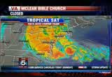
hard to believe we're already doing this. they've apparently had flooding issues in baltimore. i'm afraid we're going to see much more of that during the course of the day. let's show you the latest, rain continues to fall, overnight, just a steady rain, now in parts the area it's becoming a heavy rain, particularly to the east and the south down into now pushing across the beach. even out to the west, those of you what haven't seen a lot, frederick and front royal, rain thereby picking up here over the next several hours. all right, let me show you the latest tropical satellite picture here and our storm only intensifying overnight. hard to belief, i'm looking at the last couple frames there, looks like that eye is trying to reemerge. we have cbo, over the center of the storm, but it's basically looking more impressive here. that's the bottom line on our early satellite pictures.
7:48 am
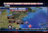
85, dusts to about 100. likely to keep that intensity as it makes land fall somewhere in southern new jersey perhaps parts of delaware later tonight. so that's going to be the big concern . i mentioned to tony, the latest computer runs are looking more in favor for us. i'll show you why in a second. here are your winds, 85. it's now moving to the north. wed was the north and east. north and west and eventually west as it gets pushed back towards the washington area, there you go, looks like it makes land fall at 8:00, 9:00 tonight. it's not terribly windy now, look out, the winds are going to increase. for a time later tonight, they'll be at hurricane force here for much of the viewing area. this is what i wanted to show you, the tropical models. notice the tight clustering effect there in southern new jersey, but then, several of the models to want bring it out across north central maryland and washington here. it would likely still be a very strong tropical storm or
7:49 am

perhaps even a hurricane for a time, this would not be a favorable scenario for us. just take all necessary precautions now before the storm moves in later today. 54 degrees, northwest 35 to 55. gusts to 70. it's not terribly windy now, but it will be later today. get ready for it. >> thanks tucker. >> all right, we continue to follow the path of hurricane sandy and a serious concern is the storm surge in the chesapeake bay. >> some parts of indianapolis are already feeling the impact. our holly morris is there watching the water rise. good morning, holl. >> reporter: good morning to both of you, everyone here is prepared and ready. they've been through this before, though this one has an ominous feel. they are sitting and ready to wait it out. they've been working all weekend long, many of the businesses down here by the city dock are closed. they have the sandbags piled out front, but not all businesses are closed. you can't close when you're an institution. that's where ted comes in, good morning to you, sir.
7:50 am

>> how are you doing everybody? >> you got a new rain suit? >> we use is for our deliveries. >> i like it, it looks nice on you. could see you coming. when you first came up, tell them what you said. >> if you want some coffee. >> reporter: i said okay we'll take you up on the coffee. we've had numerous offers for coffee, hospitality goes tout all of indianapolis. you have been how long here? >> 48 years. >> reporter: how often have you closed? >> never. >> reporter: are you planning on closing today? >> never. >> reporter: what happens if you lose power? >> we'll just probably wait it out, normally when we lose power its only been for a little while, so we wait. and we'll do the same, if it happens to be longer, it'll be longer. we have breakfast upstairs, they take turns working, and not one time have we ever opened late or been closed because of any circumstances. none. >> guess then people, do a lot of people come over because they know you're open. one of the few places. >> yeah, once they kind get
7:51 am

stuck in the house for so many hours, they want to get out. rain, snow, whatever, they come out. and mainly when it gets really bad, it's for the services, police, fire, those guys come out, city of indianapolis, they have city food. when we had the big snowstorm, humvees, national guard came out, we made food for them. anybody that needs to be out, the workers, they can come in and get out of the weather. >> reporter: you are the most reliable people i know, officially. i'm telling you, what are you thinking here morning as we're standing here? we see the waters rising, boats are tied down. >> i think it's probably going to flood like it has in the past years. i just hope not too bad and i hope the winds aren't too bad. >> since you've been in the situation before, they say it could be a storm like none other. do you get nervous or you just kind of know it? >> no, it's just life you throws you what it is, hopefully nothings, if it does,
7:52 am

as long as you're healthy, family healthy, you can fix everything else. if the store floods, we lose some food, we can always fix that. as long as you're healthy, everything else goes by the wayside. >> reporter: leave it to ted to give us perspective and reliability and the best crab cake i understand. >> yes, best, guaranteed. >> reporter: you go, you heard it from ted. here this morning, actually out here, it's not really that bad, it's like being out in a rainstorm. there's a little bit of a breeze, cold rain, big drops, of course there is this kind of ominous feel because we all know what lies ahead. watching and waiting here, here we are, back to you in the studio. >> all right hollywood, thank you very much. >> it is encouraging to hear that he is staying open. >> yes, it is. >> i don't know. >> i apologize for trying to get our prompter in place. we're going to have more in a couple moments. stay with us, we'll get you an update on sandy and how you can track the storm too. >> all right, we'll be right back. back.
7:53 am

this year, america's privately-owned freight railroads plan to spend $23 billion on their network. that's like building 4 nat's stadiums, 5 wilson bridges, and 8 dc convention centers...all in one year. and not a penny of it comes from taxpayers.

7:55 am

what mitt romney's tv ads say about women? or what mitt romney himself says? mitt romney: do i believe the supreme court... should overturn roe v. wade? yes. and it would be my preference that they, that they... reverse roe v. wade. hopefully reverse roe v. wade. overturn roe v. wade. planned parenthood, we're going to get rid of that. i'll cut off funding to planned parenthood. anncr: no matter what mitt romney's ads say. we know what he'll do. president obama: i'm barack obama and... i approve this message. freight railroads plan to spend $23 billion on their network.
7:56 am

that's like launching 4 mars rovers, 10 gps satellites, and 20 space shuttles ...all in one year. and not a penny of it comes from taxpayers. a good way to track the storm is with the fox 5 weather app. we have more details on that. >> reporter: allison and tony, we know people are very busy and they have a lot going on right now because of the storm. one way you can keep up with what's going on and you don't have access to your television is either through your ipad or your smart phone, doesn't matter if it's the apple or the droid. what you can do is search on the dc weather and download the fox 5 weather app. once you get that fox 5 weather app, here's the some of the
7:57 am

things you'll get access to. hd radar, realtime doppler, you can narrow it down by using the city name or the zip code. you'll get temperatures, updated forecast for the day, for the week, you can also follow the tweets of the fox 5 weather team. we also want to show you this, this is a picture that someone has sent us because you can send those pictures as well. this is a picture sent yesterday by our viewer sherry. you can clearly see what's going on there. flooding taking place in the front yard. thank you very much for doing that. so we to want tell you to keep sending those pictures in. we love to get those pictures, we may use some because we know things are going to get interesting. back to you. >> all right, thank you very much. >> very early for those flood pictures. >> just imagine later. stay with us, we'll have more coverage coming up in just a couple of moments. anncr: which do you believe?
7:58 am

what mitt romney's tv ads say about women? or what mitt romney himself says? mitt romney: do i believe the supreme court... should overturn roe v. wade? yes. and it would be my preference that they, that they... reverse roe v. wade. hopefully reverse roe v. wade. overturn roe v. wade. planned parenthood, we're going to get rid of that. i'll cut off funding to planned parenthood. anncr: no matter what mitt romney's ads say. we know what he'll do. president obama: i'm barack obama and... i approve this message.
7:59 am

my name is julian bond. i know a little something about fighting for what's right and just. maryland's gay and lesbian families share the same values and they should share in the right to marry. i believe people of faith understand this isn't about any one religious belief. it's about protecting the civil right to make a lifelong commitment to the person you love. join me in supporting question 6. it's the right thing to do.
8:00 am

straight ahead at 8:00, surviving sandy, the east coast shuts down as the deadly superstorm moves closer from school closings to storm surges, we have you covered with live team coverage all morning long. good morning everybody, i'm tony perkins. >> i'm allison seymour. right now, the storm is making its way up the east coast, poised for a district hit on the mid-atlantic tonight. >> in preparation of that,
8:01 am

states of emergency have been declared from virginia to massachusetts, and president obama has promised a quick federal response. experts say sandy could impact some 50 million people up and down the east coast. it is already blamed for the deaths of 65 after sweeping through the caribbeans. >> now here at home, officials aren't taking any chances. >> that's because most schools in the region are closed, so is the federal government and the dc city government. you can see the full list of delays scrolling at the top of your screen and online at myfoxdc.com. any decision about when it will reopen is hours away. services also suspended until further notice. and amtrak has suspended service in the northeast corridor. airports aren't in much better shape, nationwide airlines have pulled the plug
8:02 am
on more than 7,000 flights. but at this time, our three local airports are still open. you need to call in advance though to check and make sure your flight is still operating. for more now on where sandy is, where it's going, we turn to tucker barnes. >> good morning, yeah update here from the hurricane center, winds still 85 miles per hour, it's a very strong, very powerful storm. tropical storm winds extend from maine to the north carolina that the hour. and fortunately we're right in the middle of it. things are only going to get worse around here during the course of your monday. i want to point out a couple features, good band of rain setting up. this is one of the outer bands associated with a sandy moving along the 95 corridor. we're starting to see the heavier rain now, right up towards baltimore where they've got flood warnings. then back down into southern maryland, california, you're getting heavy rain. also want to point out we're not starting to see the winter
8:03 am
weather break out. there's a blizzard warning for parts of west virginia. they could get two to three feet of snow. so if you're a viewer out there or you're traveling out to the west, be mindful, it's going to turn into a serious winter event out there in a hurry as these bands of rain encounter some very cold air. let me showout bigger picture, there's the storm lurking off the southeast coast. you can see the banding effect i mentioned just a moment ago. the center now 2, let's see let's see 260-miles to the south and east of atlantic city. would not be surprised at all if it makes land fall close to atlantic city. southern new jersey, maybe the bay of delaware later this evening. 8:00, 9:00, 10:00 tonight. we're going to have rain throughout the day today. winds will steadily pickup, then as that center of circulation presses close to the washington area, winds are going to gust i'm afraid close to hurricane speed around here later tonight. we have a hurricane force winds for a time, 9:00, 10:00, 11:00
8:04 am

tonight. barometric pressure, 946- millibars. i'll tell you a fact about that. sustained winds later today, 30 to 50 with gusts at times, 60 to 70 plus. in fact the latest guidance suggesting we have got a better chance of some gusts over 70 miles per hour. the best chance for that will be to the north of the city. you can get up into howard county, up towards baltimore, the northern part of the bay, you have the best chances for winds in excess of 70 plus miles per hour. all of us unfortunately are going to be dealing with serious wind gusts. rain total five to ten, flood watch, heavy amount of snow. all right, quick look at your forecast, we're going to go with high temperature of 54 today. here's the latest information, we're just getting it no now. 85. movement now, north, northwest, we're starting to see that change. yesterday it was north and east. earlier this morning, movement was north, now it's north, northwest at 20. so we're starting to see that change of pace there in that left hook we've been expecting.
8:05 am

there is your guidance, looks like it hits just north of us as we get into the overnight hours. more details on the weather in just a minute, back to you. >> all right tucker, thank you very much. big issues today will be the heavy rain, the flooding, down trees, power outages. >> holly morris is live in indianapolis with a look at how the coastal community is coping, but we begin with lauren demarco, she's already feeling the force of the storm, good morning, lauren. >> reporter: good morning to you, definitely seeing that high tide start to move in within the next half hour or so. we've got a significant amount of flooding board walk itself. several inches of water. we continue to see waves making their way over the sea wall at this point, also reports of some flooding on the roads out there as well. i do want to mention that earlier today, it was about 3:00 in the morning, we headed out to the pier off of wooster street, and there were really
8:06 am

heavy waves crashing in the pier actually going on top of it. we just spoke with some police police officers outside who say that they have heard that the pier, at least part of it has crashed down now, and has succumbed to those waves. part of the pier is now gone. we're going to head out and confirm that ourselves. that's what they are hearing. so again, that's definitely a significant impact of hurricane sandy. also, again with these waves, we're getting reports that just off of ocean city, buoy's picking up 24-foot waves. definitely some very strong waters headed our way. also concerns about the other side, bay side flooding there as well now. there are mandatory evacuations underway, everything below 17 17th street here on ocean city and about 200 people, police statement it did opt to stay and not leave their homes. police and fire out trying to get those folks to leave at this point. we've been seeing a lot of
8:07 am

emergency vehicles, some fire trucks went by with their sirens blaring. i did make a call to police, they say they haven't had any rescues so far, because they are try to get those people out and ocean city mayor rick had expressed concern about that as well. >> it is not to be out there and we don't want to do anything that's going to have, put them in jeopardy, certainly don't want to put our first responders in jeopardy. and we want everybody to take that into consideration before they make some silly mistake that could effect more than just them. >> reporter: so again, the roads into ocean city, route 50 has been closed off at the bridge. route 90 does remain open. again everything below 17th 17th street closed. they urge folks to evacuate. as far as power, we have not lost electricity, so good news there, again, that of course is the concern we are approaching high tide.
8:08 am

so seeing some more flooding as well. one other concern as we move forward will be beach erosion. very projects in 2010 was the last time they did beach fill. that will be something we're looking forward to in the days need see what type of erosion here does occur following hurricane sandy, back to you. >> those are dramatic pictures behind you right now, lauren, i know high tide is in adjust few moments, you can see the difference in theaways right now, lauren demarco, thank you very much. further up i-the 5:00 with the city that never sleeps is virtually shut down this morning. in new york all trains, subways, and bus services has been suspended. schools in the big apple are closed. now the biggest concern is the tidal surge which could reach up to 11 feet in parts of manhattan. mayor bloomberg ordered nearly had hundred thousand people to evacuate. in new jersey, governor chris christie issued evacuationers for folks along the coast,
8:09 am

board walks, and casinos in atlantic city have been empty since yesterday. and here at home, fishery warning people to stay off the roads -- officials are warning people to stay off the roads. >> wet roads and down trees could make it a slippery ride. julie wright joins us next with a check on traffic. . >> reporter: allison you're right, those long and windy roads in route seven were just covered with leaves over the weekend. approaching 10, no one is' getting by at this time. we had activity south on fairland road. that crash has cleared. again to update our on the
8:10 am

commute around town, definitely dealing with the wet pavement, we are anticipating the roads to deteriorate as the storm continues closer to us. we already have beach drive shut down, this is typically a common area where we tend to see standing water once the weather and winds pickup. little falls parkway between massachusetts a and river road. that's already shut down, and of course the parkway blocked off between wayne avenue. you will find metro rail service has been suspended amtrak, the northeast corridors between dc and boston. that is also shut down and of course metro bus and metro access, montgomery county has been suspended as well. that's a check of your fox 5 on time traffic. >> thank you very much. prince georges county officials opened a shelter at charles h. flowers high school in springdale. officials say more could be opened if need be. the shelter will be managed by the red cross. county officials say residents
8:11 am

should call 311 or check the county's website for shelter updates. and our storm coverage is just getting started, still made at 8:00, sandy's impact on early voting the and the presidential campaign trail with eight days until the election. and just a rembledder, stay with fox 5 on air and online for the very latest on hurricane sandy. whenever safely possible, take a picture, upload to our website. my fox dc doing is the address. we'll be right back.


8:14 am

the hung is forcing big changes on the -- hurricane is forcing big changes on the campaign trail. >> president barack obama is scrapping plans to campaign in three states and is flying back to florida to monitor from the white house. over the weekend the president visited the management agencies headquarters for briefing on the latest storm information, he also urged everybody in the storm's path to quote take this one seriously. >> governor mitt romney also canceled three campaign stops in virginia yesterday. and one in new hampshire for tomorrow. he instead held a rally in ohio with running mate paul ryan as heart of his bus tour. today romney will be heading away from the atlantic coast and he'll campaign in ohio, iowa, and wisconsin. and the storm system is also forcing early voting to be
8:15 am

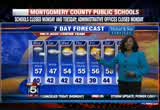
suspended in dc. in maryland, governor martin o'malley declared a state of emergency and ordered all early voting centers to close. the dc board of elections will decide today if early voting will reopen later this week. over the weekend, there were long lines in both the district and maryland. turnout was much bigger than expected. the lines were so long that a few gave up. some tell us they wait four hours to cast a ballot. wow. >> yeah. all right it is 8:15 now. >> let's get the latest from tucker barnes on, what else, hurricane sandy. tucker, i wish we were talking about something else today. >> wouldn't it be nice? typical of october. let's get to it right away, a lot of information to share you. let's start with the radar, good rains now, and in fact flooding issues up towards baltimore. so moderate rain here for the first part of your day. rains will intensify during the course of the day and so will the wind. you step out this morning and
8:16 am
winds are only blowing 25, 30. the worst has not yet passed. that will arrive later tonight as we see the actual eye, the center of the storm make land fall just to the north and east. let's push on, i want to show you a couple features here, and first let's talk about the tropical satellite picture. 260-miles south and east of atlantic city. the eye has been appearing and reappearing during the overnight hours. right now it's what we call cbo, but believe me, it's there. 946-millibars, that is a very strong storm for this north latitude. again, this storm means business, it looks like it makes land fall some place in southern new jersey, perhaps the bay of delaware later tonight. so we're going to have to really keep an eye on that. all right i want to show this feature, these are our spaghetti models. it's a tight cluster showing the path of the storm. looks like we have a good handle on things here. storm makes land fall, but look
8:17 am

at what the spaghetti model, look what the computer models are suggesting will happen later tonight. looks like the storm will pass over parts of our viewing area, perhaps north central maryland, perhaps it'll do a loop there across dc. this would not be good news for us. that would keep the center of the storm along with some extremely dangerous winds and torrential rains around here for longer period of time. just be weary of that, if anything, the track looks formittable this morning than last night. there we go at 8:00 tonight, winds are picking up around here. overnight, there's now a suggestion that we could be having hurricane-forced winds near washington and on the western show of the bay. if that occurs with that would be the worst case scenario, we would have more with power and downed trees. when you talk about hurricane- forced winds, structural damage as well in some of the houses. wind gusts put in motion for you, and i showed you the
8:18 am
possibility there. 5:00 tonight, the winds will really start picking up. watch what happens tonight, 10:00 tonight, winds gusting 69 here in washington, 69 in gathersburg. we're all going to get in on the serious winds overnight. things will gradually get better tomorrow, but it is going to take a good two days before we can call it quits on sandy. forecast for today, 54 degrees, winds north and west, 55, gust 70. the worst will get in here late this afternoon and tonight overnight into early tomorrow. we haven't seen anything yet. all right, more details on the weather coming up in just a minute, back to you guys. >> thank you. we mentioned a little earlier that casinos and the famous board walk in atlantic city are basically a virtual ghost town now. >> yeah that area and all along the new jersey coast is bracing for major flooding. steve keelie is live this morning with more, steve. >> reporter: will grew up here and i was one year old when the
8:19 am
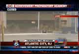
worst storm ever hit in anybody's memory, i was too young to remember that, i've been through many, this already, 13 hours before the worst hits is looking like one of the worst ones i've ever lived through. i've got water on both sides of me now, and underneath me, and i've never seen water running under the board walk about to meet the ocean from the bay. the streets are flooded, tony, you mentioned the casinos here, that is the newest casino, the rebel casino, two and a half billion dollars, that is already flooded. that is their new parking garage, they evacuated all the casinos here at 4:00 yesterday afternoon and good thing they did because these casinos would have been full of people and those people would have nowhere to go, nowhere to get out because the roads are starting to flood already. we're expecting the worst to hit at 8:00 tonight, and then hit for hours and hours after that into tomorrow morning. the waves and the ocean coming the other way. these are dunes in front of us.
8:20 am
normally these are a higher when you're walking here, you can't see the ocean, and a lot of people complain about the view being missed just because they want the safety of the houses and the casinos so they build up these mountains of sand. weapon the mountains have now become mole hills and the waves are so big you have no problem seeing the ocean. so this is the fourth time ever in atlantic city's history that these casinos have been closed, two types in 14 months now. allison and tony, only twice ever in this long city's history has there been a mandatory evacuations in the past 14 months. the problem is 14 months ago turn hurricane irene, that just perhapses, it does not do the damage everybody predicted. a lot of people that evacuated suffered more with the evacuation centers than those who stayed behind. everybody was worried that people would say, that's the lesson they learned, they're going to stay behind this time. we see a lot of people sticking around. couple of bars are open,
8:21 am

they're having hurricane parties. everything isn't so bad right now, but the partyings going to be turning a lot of danger real soon if everybody sticks around tonight. there's no way in or out now. the main highways into this town are now shut down. and police are now using emergency vehicles, four wheel drives, they can't use police cars to get around. and a lot of these veteran officers are telling me if they drive around they're seeing streets flooded they've never seen, even big puddles on and this again, long before the worst of this stuff hits here in new jersey. tony, allison. >> steve, that is extraordinary. as you said, great concern because the worst is yet to come. stay safe steve, we'll see you later on, thank you. those pictures are amazing. all right that's in atlantic city. it is now 8:21 here on this monday morning. coming up next, not pausing for sandy, we're going to show you which branch of the federal government isn't skipping a day of work for the storm.
8:22 am

and later we'll go live to indianapolis for a look at conditions there as sandy moves closer to making land fall. ng
8:23 am

anncr: it's said that character is what we do... when we think no one is looking. mitt romney: believe that they are victims. anncr: mitt romney thought no one was looking when... he attacked forty-seven percent of americans. his companies shipped jobs overseas. his plan cuts millionaires' taxes, but raises yours. he'll voucherize medicare... and make catastrophic cuts to education. so remember what romney said... and what his plan would do. president obama: i'm barack obama and... i approve this message.

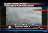
8:25 am

top court is not taking a break. today the justices of the supreme court will hear arguments in a battle over copy right protection. the case centers around a thy graduate student who tried to tap into a market for cheaper college textbooks, but was selling copy righted books some of his relatives bought overseas. thousands of utility workers are hard at work today. >> extra crews have been brought in as the region braces for the possibility of massive power outages. pepco requested nearly 4,000 additional crew members from as far away as alabama. bge says it has more than 3,000 ready to respond to widespread damage and outages. the power companies will not know how long it'll take to restore power until after the storm has passed. this is a live look now at our camera in ocean city, maryland, where high tide occurred just about five minutes ago. and you can see the surf there
8:26 am

is particularly strong and violent at this time. we've been watching it during the last several minutes. and it has picked up the surf action, the wave action has picked up in intensity. >> we were waiting for this, of course our lauren demarco is there, we wanted to take the shot just to show you what is going on now. of course the worst yet to come for all of us here in this area. we saw what has already happened in new jersey on the beach there, atlantic city, the board walk, this though a look at ocean city, maryland, again, high tide. very dangerous out there. surf very high out there now. all right still knead our next half hour, from the beach to the big apple, how other parts of the east coast are getting ready for sandy's wrath. it is now 8:26, you're watching fox 5 morning news, we'll be right back.
8:27 am

hey! hey, baby. [ starts car ] were you eating smoked sausage in here? no! no. could have gotten me one. i did. try the unmistakable flavor of dunkin' donuts' smoked sausage breakfast sandwich. it's deliciously irresistible. hurry in today. the smoked sausage breakfast sandwich is only at dunkin' donuts for a limited time.


8:30 am

here's a reminder for you, most schools, the federal government, the dc government all closed today. and all metro service has been suspended. we have the full list of closures and delays scrolling at the top of the screen and on our website. >> all right we to want get updated on what's happening with the storm, they were both here, she is here to tell us what's happening. >> it has speeded up. it's just getting, going to get to us just a little bit faster looks like. it's kind of, it hasn't intensified anymore, but it has gained a little bit of speed. take a look at these pictures. this is ocean city, unbelievable. >> wow. >> look at that, and you know what, this is just the beginning. so that's a pretty good indication folks of what we are in for, so just be prepared for that. you can seep just how high the waves are coming and the, just how high the water is there, and wow, we have a lot of time
8:31 am
to go yet even before the storm even makes its way an to the shore and on to coasts. you know what, that's a pretty good indication of what we're in for. once again, i want to encourage you to please take this storm seriously. here's a look at our accuweather fox 5 radar. we're already getting rain here across the dc area. some pockets where you see the orange and yellow, that's heavier rainfall, it's going to become more widespread, heavier and steadier as we move through in the course of the day. let's look at a track of that system. as i mention the storm has picked up a little bit of speed, it's now moving north, northwest at 20 miles an hour, and it's, you know, getting closer. so definitely we're going to keep an eye on it. here's a look at the track right now. we're talking by the 2:00 hour, it'll still be a category one hurricane. it makes land fall and becomes pretty much a low pressure system and loses tropical characteristic characters, but that doesn't mean anything. because it's a low pressure
8:32 am
system and loses its tropical characters does not diminish the strength or the impact of this storm and what it's going to have. don't think just because it happens, i don't have to worry about it. it's actually just the opposite. it's goinged to to do a lot. we're looking at the storm being more powerful than hurricane irene was because the wind field is so massive on it. you can see the cone, it stretches up into canada, down across areas of new england, and right now, tropical storm force winds are being felt 175- miles or less from the center of the storm. hurricane force winds being felt at least, you know, even more than that. so that's a pretty good indication. here's the radar for you, and you can see where we've got the heavier rainfall starting to move its by that, showing you this is just going to continue to head across our area and what you have to be in store for. rainfall amounts, not talking a couple of inches, we're talking eight to ten for the dc metro area with possibility of even
8:33 am
up to 12-inches. six to eight to the north of us with the rainfall. and on the back side of that, we're talking some snowfall. look at future cast, across areas of the mountains, pennsylvania toe ma highlands, we are talking chance of seeing some snow, as the center interacts with the frontal system, we have colder air situated there. so, sunday snowy side, the blades warnings in the mountains, that blades warning in effect for this burglar area shaded here monday to wednesday, 8:00 in the morning. so know and gusty winds for the far west over the higher elevations. we're talking heavy, wet snow through here. we could see in excess a foot of snowfall. gusty winds meaning blizzard conditions up to 60 miles an hour winds. storm surge another big issue.
8:34 am

four to eight feet possible up towards new york, we're talking six to 11 feet of storm surge here. so, expect torrential rain and gusty winds. high wind warning is today through tuesday. coastal flood warning tonight until monday morning, and then the far west, we've got that blizzard warning we just showed you. please take this very seriously. the wind field, we could see those winds gusting even up to 75 miles per hour before it's all said and done. anything on your balconies, you want to take it off, anything on your front porch or your steps, 50 million people could be effected. make sure you bring in your pets as well. if you are up in a high-rise, you are definitely going to feel these winds as the impact kicks in a lot more than you will if you're down on a lower level. so we don't get much of a break until we head into thursday. the drier weather kicks in. in the peen time, heavy rain, torrential rain, strong dangerous winds to contend with, tony, allison. >> all right thank you very much.
8:35 am

now we of course are very concerned about what that storm will do to our area. >> but in new york city, they are bracing for some serious scenarios indeluding flooding from the major storm surge expected in low lying areas of manhattan and long island. and antonin lewis is in lower manhattan this morning with more. scary stuff coming from the advisories as far as new york city goes, antonin, good morning. >> reporter: good morning allison, you are right. part of the problem is that this area where we are, battery park, is in lower manhattan, it's in what's known as zone a. those are low lying areas that are prone to flooding. i'm going to show you why the concern is so high. this is the harbor and to give your dc audience there a perspective of where we are, the statue of liberty is right there in the dusk, back there in the fog, you can't see her from here. we are just southwest of ground zero and wall street is just over here right in front of me off to the side there. what we're looking at now is
8:36 am

the harbor because this is high tide. it's coming in, up, and over. i'm standing in now probably two to four inches of standing water. this is mind you several hours away before the impact goats where we are right now. so this is what we're dealing with. obviously it will recede some time. this is probably the problem, this is why the mayor and other city officials called for mandatory evacuations. which includes parts of brooklyn, parts of long island as well as parts of queens, and of course where we are in lower manhattan. so this is a very serious deal here. remember hurricane irene we had flooding issues, this is going to be a little bit more forceful. little bit more powerful than what that is. also before you get away from us, just to let you know more about the impact that's having here on our city, wall street, new york stock exchange is actually going to be closing down today and this is not happened since 1985. we're talking about a serious
8:37 am

impact, all metro service, subway lines, trains, all that has been suspended. new york city public schools closed today. right now we're mainly dealing with the wind which is my voice is trembling. the wind is starting to come up a little bit. again we are still several hours away from the brunt if you will, so this is like maybe the calm before the storm, we've got two to four inches standing water here. we'll see what to check in. tony and allison let you know how we're fairing right now. as far as this goes, yeah, this isn't good. this isn't good right now. we're going to send it back to you in dc from new york. >> if you hadn't said anything, you look like you have nervous of steel, thank you so much. >> reporter: all right need them. >> miss you too, later. if you haven't noticed by now, sandy is the biggest story in the dc region. >> sarah joins us live with ways you can stay connected during the storm, hi sarah. >> reporter: hi, i know people are not going to see the tv
8:38 am

24/7, the power could be out. hopefully they have the phones charged, or other tablet device, that type of thing so you can keep an eye on the weather. you can do so through the fox 5 weather app which you can get the android phones or also, you know, any smart phone out there. you just search dc weather, but this is the fox 5 weather app. this is what it will bring you to. as you can see, we're zooming in now and you can see the tracks of this storm, and you can zoom in to your neighborhood putting in a zip code, town name, that way you can get a better idea of what where this storm is in your neighborhood. now, off to the left hand side you're going to notice current conditions, temperature, also the seven day forecast, along there as well. now dollar lot of different things that you will be -- oh and i want to mention hourly too. that's something that's key so you can see hour by hour what is happening in your neighborhood. there are a lot of different
8:39 am

things this app can do for you as well as pull up video, we have video forecast that tucker barnes, gwen, what they have to say throughout the morning hours, you can pull those up and those will play for you as well. also, we know that we cannot be everywhere where you are in certain areas. we don't have enough crews to get everywhere, but you can help us tell the story of what the storm is like in your neck of the woods. you can do that by going up to the very right hand corner where you can hit submit. you're able to submit photo or video, and you can put that in there directly so we can see what you're experiencing and also get that on the air as well. the other thing is, through the blog feature, you're going to be able to pull up fox 5 weather on twitter, this is where tucker and gwen throughout the morning are giving you up to date information as to exactly what the wind speeds are, when you could maybe expect the hurricane to be getting into your area. and what the wind speeds may be
8:40 am

like in your in effect woods for that area. so there is a lot of different things you can do through this, of course, fox 5 weather app, again you can get that through your smart phone, search dc weather on the android market as well. it's very helpful. its been helpful before we've had a hurricane, you can imagine how many it'll help you during this storm as well. to help you ride it through, back to you. >> all right sarah, thank you very much. hey, i should mention, you know, some other things that went on, the san francisco giants won the world series. >> i thought the tigers won? >> no. >> and the redskins lost yesterday. worst loss of the year so far. >> we could have kept that part be. >> that's the only time we're going to mention that. >> and i knew who won. still ahead at 8:00, our team storm coverage does continue live from indianapolis, hollywood, good morning. >> reporter: good morning you, i tell can tell you here, the rain is picking up, residents along the bay obviously concerned about the massive storm that we're all going to have to endure.
8:41 am

coming up,er indeed looking at how people here in indianapolis are planning for hurricane sandy. what they plan to do in the next couple days live next on fox 5 morning news, stay with us. [ earnest ] out of the blue one day, we were told to build a 30-foot stage. gathered the guys and we built that 30-foot stage, not knowing what it was for. just days later, all three shifts were told to assemble in the warehouse. a group of people walked out on that stage
8:42 am

and told us that the plant is now closed and all of you are fired... i looked both ways, i looked at the crowd, and...we all just lost our jobs. we don't have an income. mitt romney made over 100 million dollars by shutting down our plant and devastated our lives. turns out that when we built that stage, it was like building my own coffin, and it just made me sick. [ male announcer ] priorities usa action is responsible for the content of this advertising. prand you're seeing that rightno quit in amnow.a...ction over five million new jobs. exports up forty one percent. home values... rising.
8:43 am

our auto industry... back. and our heroes are coming home. we're not there yet, but we've made real progress and the... last thing we should do is turn back now. here's my plan for the next four years: making education and training a national priority; building on our manufacturing boom; boosting american-made energy; reducing the deficits responsibly by cutting where... we can, and asking the wealthy to pay a little more. and ending the war in afghanistan, so we can... do some nation-building here at home. that's the right path. so read my plan, compare it to governor romney's... and decide which is better for you. it's an honor to be your president... and i'm asking for your vote... so together, we can keep moving america forward. i'm barack obama and i approve this message.
8:44 am

welcome back at 8:43, if ewe didn't already know how big of a storm sandy really is. take a picture of it from space. take a look at that picture, the nasa image shows the storm as it looks thursday when it was still a category two hurricane. more recent images show the cloud cover over the east coast, and the cold front it will collide with. >> that's a big storm. >> looking at that situation that we've been talking about. the chesapeake bay area is particularly at risk of a storm surge. >> there is flooding in parts of indianapolis this morning, and that's where hollywood morris is live with the latest -- holly morris is live with the latest. the wind is picking up too. >> reporter: yeah it is, it ebbs and flows, it'll start to rain harder and the wind will flow below, then it'll ease off. right now it's kind of like a cold, dreary rainy monday morning. the thing i noticed differently down here on the city dock is the lack of activity. you know usually this is hustle and bustling on a monday
8:45 am

morning for sure. a lot of people really not getting out. they probably spent most of the weekend getting ready and now they're just staying in and waiting for hurricane sandy to come. obviously here, living on the water, they know of the threat of potential weather, and things like this, of course this storm is bigger than most. and so the concern is high here obviously. to kind of give you an idea of how things are right now, you can see the rain, you can see people's boats here. they have been adviced they need to at the timer their boats down tightly. many could remove their boats. for people in low lying areas, they have asked them to move inland, stay with friends and family. false you live in a low lying area to move your car because obviously you don't want your car flooded. in fact they've opened up four parking good mornings here in indianapolis so people could park there. they do have a hurricane line for people to call. it's not an emergency line, if you have an emergency, you call 911, but during the storm, if
8:46 am

you have questions or concerns, there is a line that you can call. you can easily find that on the general indianapolis government website, it is closed today except for its central employees. so, they're pretty much as prepared as they can be doing what they can ahead of time. many of the businesses along here are not open. there are a few that are open, but most are closed. they do have the sandbags out in front of their doors, they're piled up hopefully trying to prevent any water that would come in, especially obviously if the water would come over the wall here. the water's pretty high here, but it's still has a little bit of a ways to go before the actual parking lot would be flooded here. there is some standing water, a lot has to do with drainage problems, but you know, people here in indianapolis, like i said, they dealt with this before, inspect, they remember all too fondly or not so fondly i should say irene from last year.
8:47 am
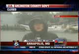
>> i didn't lose power, my friends didn't lose power. the streets, another place on main street lost power. i was fine. >> reporter: that may not be the case this time around. any time this comes along, we compare storms. this is going to be a lot worse than irene. so watching and waiting here in annapolis. >> we've talk at lot about the anticipated power outages associated with sandy. >> they are expected or it major. is your utility ready to go into action after the danger passes? well let's find out. anderson with dominion power is on the phone with us now, good morning, thank you for joining us. >> good morning, tony and allison, thank you for having me on. we are ready. we are very ready. we've done a lot of
8:48 am
preplanning, we've done everything that we can to prepare a storm of this magnitude. now we are in waiting mode and when the storm does impact us, and it becomes safe enough for our crews to get out into the field to make repairs, we will begin restoring power. but we do want to be realistic and make sure people understand, as prepared as we are, this is a huge storm, and there will be a lot of power outages and the outages will be multiday. >> i want to ask you the same question i asked pepco earlier, i know the call has gone out for additional crews to come in to help out, but i know also a very wide area of the country is going to feel the effects of this storm. how difficult has it been for you to get other crews to commit to coming here? >> well we are very fortunate to be part of a well orchestrated mutual aid program. what that means is all the utilities work cooperatively with one another. we've requested it thousand --
8:49 am
2,000 resources to come from other utilities. many of them are south of us. so just as soon as the storm clears their service area and they are confident that they are able to release their crews, they will send them up our way. we feel very good with the numbers that we've secured so far, and between them and the crews that we already have on our system and our contractors, we believe we'll be able to meet the challenges ahead. >> and just to back it up a little bit, let me just ask you, is it really those down old trees that we love so much in good times, is that the main issue here coming down on those power lines and the like? what are you really looking for? >> it's downed trees across power lines that could pose threat. we're looking at winds that could be 50 miles per hour with gusts of 70 miles per hour for sustained period of time. perhaps 24 to 36 hours. that's going to weaken even trees that are pretty healthy.
8:50 am

so we just, we're anticipating between trees and debris that can blow into the power lines that there will be significant outages. >> and what do you advice people to do when those outages occur? do they have to call and let you know, or are you able to see on some map or something where it's happening? >> yeah, i wish we had some sort of map, we are relying on our customers calling us at 1- 866-dom-help. we also have the ability to have customers report their autoages online through their smart phones too. so we have a mobile app and customers just need to go to www.dom.com and they can report outages but also track restorations through that app. >> realistic, but confident, i like it a lot. thank you so much. >> thank you. >> we'll talk to you again, i'm sure. coming up next, a break
8:51 am

from storm coverage far look back at an all-around ugly sunday on the gridiron for the washington redskins. time right now is 8:50, and you're watching a special edition of fox 5 morning news, we'll be right back. [ mitt romney ] we have to work on a collaborative basis. look, the reason i'm in this race is there are people that are really hurting today in this country. and we face this deficit -- could crush the future generations. and republicans and democrats both love america but we need to have leadership -- leadership in washington that will actually bring people together and get the job done and could not care less if it's a republican or a democrat. i've done it before, i'll do it again. i'm mitt romney, and i approve this message.

8:53 am

all right well of course we will have much more storm watch coverage in just a moment, first though, the giants closed out the world series in detroit. >> marco singled home the breaking run in the tenth inning for san francisco. to go up by a run, and then reliever romo looked to close it out. >> 2-2 pitch. got him, and the giants have won it all. >> there it is. the san francisco giants complete the sweep of the tigers with a 4-3 win in ten innings. pablo sandoval was named series
8:54 am

mvp. this is the team's second world series title in the last three years. well the state of the skins looking more dire if they hope to make a playoff run. the redskins headed north to face pittsburgh yesterday and for the most part, the steelers were able to contain robert griffin the third. he threw a short touchdown pass to santana moss for his only score and had just eight yards rushing. morris rushed for only 59 yards. pittsburgh went on to win decisively 27-12. the skins had an nfl season high ten dropped passes. yeah. they are now 3-5 for the year. next up, the carolina panthers, they come to fedex field on sunday. still ahead at 9:00, scared of the storm. we will talk about this superstorm and its impact. and it can be frightening for all of us, but especially the smallest were our kids. >> i've been hearing about this. we're going to talk to an expert about how to talk to
8:55 am

your children about how to calm their fears. right now it's 8:54, the coverage of the hurricane continues next. inues next. it's my coffee when i want it. you press a button, you have great dunkin' coffee. i got my coffee for the morning, i got my dunkin' k-cup packs for the rest of the day. only available at dunkin' donuts restaurants. america runs on dunkin' coffee.
8:56 am

athat's what the plan georged allen supports... would cost our economy. newspapers called it "economically destructive." like allen's votes to give tax breaks to companies... that ship jobs overseas, his economic plan would... help big corporations, devastating the middle class. allen even voted against tax breaks for small businesses. virginia can't afford to go back to george allen. the democratic senatorial campaign committee... is responsible for the content of this advertising. (bell ringshi. yes? you know those delicious granola bunches in honey bunches of oats? i love those. we've added more to every box. really? wow! honey bunches of oats. make your day bunches better.
8:57 am

i'm drinkin' a dunkin' latte. i'm in love with my dunkin' latte. it is a treat. they're packed with flavor.
8:58 am
it's my kind of latte. try the simply delicious latte everyone can enjoy. america runs on dunkin'! creeping along, hurricane sandy slowly churning out in the atlantic. the storm hasn't made land fall yet, but it has brought cities to a grinding halt. >> millions of people without transportation along the east coast, millions expected to lose power, and flooding unavoidable. as waves several feet tall wash ashore. right now, we are taking a live look at locations along the eastern sea board where people are bracing for sandy's wrath. thanks for staying with us this morning, we're going to have live updates on sandy's slow track to the u.s., the coastline all day long. >> we want to start can tucker
8:59 am
barnes, he has the latest on sandy's strength and more. tucker, good morning. >> good morning, storm strengthening overnight. i'll show you in just a second. let's start with the local rain that's falling, and you can see we're getting good rains now from fred ringsburg right up to the district and points north and east. this is probably, saw it there in the last little look at the radar. this is one of the outing bands associated with a sandy now impacting our area. the flow will be out of the south and east out to the west into the north. parts of the area that hasn't seen a whole lot of rain, you will see it. this is one of the big stories particularly for the first half of the monday as the rain intensifies here over the next couple hours. when all said and done, you're looking at five to ten inch was rain. heavy rain expected, particularly south and east. all right, let me showout next map, i want to showout satellite radar here as we go to mac two and there is your centf
225 Views
IN COLLECTIONS
WTTG (FOX) Television Archive
  Television Archive News Search Service
Uploaded by TV Archive on
